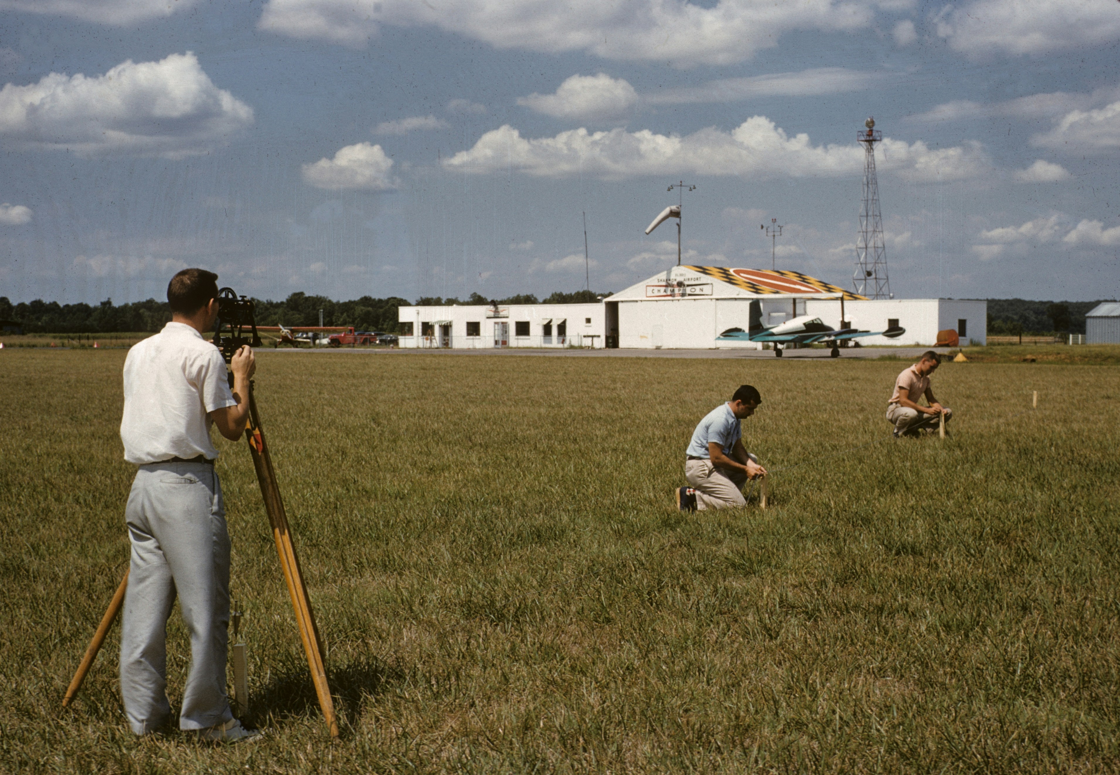
Fieldwork Lab
Master Fieldwork Methods, Data Collection & Analysis
Plan, conduct, and analyze geographical investigations. Learn essential primary data collection techniques, survey design, and how to interpret your findings in real-world UK environments.
Why Fieldwork Matters
Fieldwork brings geography to life. It transforms theoretical concepts into practical reality, developing critical thinking, problem-solving, and analytical skills essential for GCSE success and beyond.
What is Fieldwork?
Fieldwork is the process of observing and collecting data about people, cultures, and natural environments in the real world.
Why Learn Fieldwork?
Exam Relevance
Crucial for GCSE Geography Paper 3. Master the enquiry process to secure top marks.
Scientific Inquiry
Develop hypotheses, design methodologies, and draw evidence-based conclusions.
Practical Skills
Learn to use equipment, navigate environments, and work safely in the field.
What You'll Learn
- 1Design effective geographical enquiries
- 2Select appropriate sampling strategies
- 3Collect accurate primary data safely
- 4Present data using advanced techniques
- 5Analyze results and draw conclusions
- 6Evaluate fieldwork methodologies
- 7Apply ethical practices in research
How to Use This Hub
Review Methods
Understand different data collection techniques and when to use them.
Explore Case Studies
Analyze real UK fieldwork examples to see methods in action.
Practice Skills
Test your knowledge with interactive quizzes and exam-style questions.
Fieldwork Methods Explained
Understand the core techniques used to collect primary geographical data.
Observation
Systematically watching and recording geographical phenomena or human behavior.
Initial site assessments, environmental quality surveys, pedestrian behavior.
Environmental quality surveys, land use mapping, traffic flow observation.
Provides immediate context, flexible, inexpensive.
Can be subjective, observer bias, limited to visible phenomena.
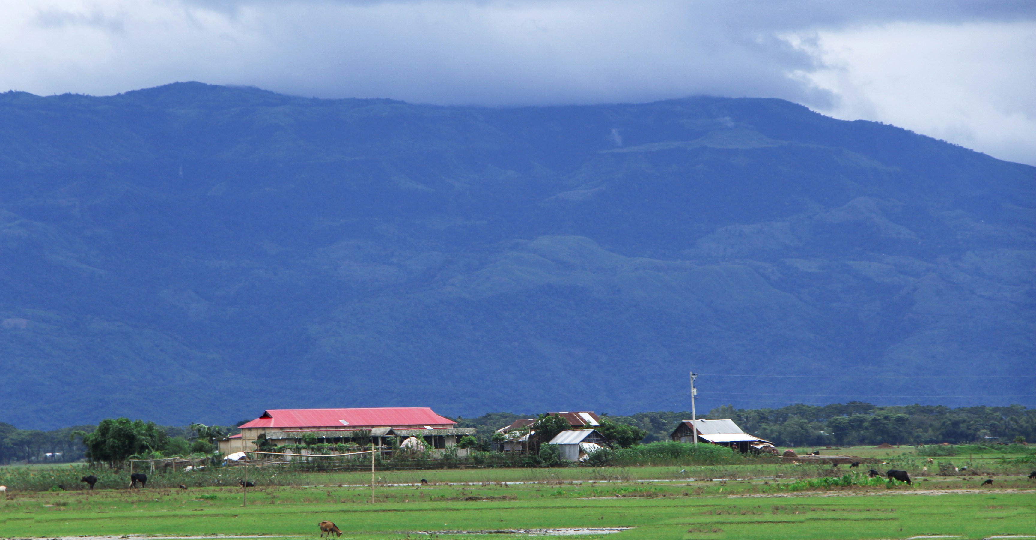
Real UK Fieldwork Case Studies
Explore authentic fieldwork investigations conducted across the UK.

London Urban Fieldwork
Environmental quality surveys, pedestrian counts, land use mapping
Clear variations in environmental quality between regenerated and older areas

Manchester Industrial/Urban
Questionnaires, building age surveys, traffic counts
Significant shift from industrial to service sector land use
Holderness Coast
Beach profiling, sediment sampling, measuring longshore drift
Rapid erosion rates, evidence of southward sediment transport
Lake District Physical Geography
Quadrat sampling, microclimate measurements, footpath erosion surveys
High impact of tourism on popular routes, distinct microclimates
Rural Scotland Fieldwork
Service provision surveys, rural questionnaires, traffic counts
Limited services in remote areas, high reliance on tourism
7 Question Types to Master
Practice all aspects of geographical enquiry with our comprehensive question bank.
Identify Fieldwork Methods
Match appropriate data collection methods to specific geographical enquiries.
Which method is best for measuring river velocity?
Design Field Surveys
Create effective questionnaires, observation sheets, and recording tables.
Design a bipolar survey for assessing environmental quality.
Analyze Fieldwork Data
Process raw field data into meaningful statistics and visual representations.
Calculate the mean pebble size from the collected beach data.
Evaluate Fieldwork Methods
Assess the reliability, accuracy, and limitations of data collection techniques.
What are the limitations of using systematic sampling for a vegetation survey?
Understand Sampling Methods
Differentiate between random, systematic, and stratified sampling strategies.
Explain how to conduct a stratified sample of pedestrians in a town centre.
Interpret Field Results
Draw conclusions from processed data and relate them back to geographical theory.
Does the data support the Bradshaw model of river characteristics?
UK Fieldwork Case Studies
Apply fieldwork principles to real-world UK geographical contexts.
Analyze the coastal management strategies at Holderness based on field evidence.
Everything You Need to Excel
Comprehensive tools and resources designed to help you master fieldwork and ace your exams.
Interactive Tools
- Fieldwork Method Selector
- Survey Design Tool
- Data Collection Calculator
- Sampling Strategy Analyzer
- Field Results Analyzer
Learning Resources
- Comprehensive Guides
- Step-by-Step Tutorials
- Downloadable Worksheets
- Real UK Examples
- Report Templates
Progress Tracking
- Track Your Scores
- Visualize Improvement
- Identify Weak Areas
- Personalized Recommendations
- Achievement Badges
Exam Preparation
- Exam-Style Questions
- Model Answers
- Common Mistakes Guide
- Time Management Tips
- Command Word Practice
Choose Your Difficulty Level
Select the level that matches your current study stage. Content adapts to your chosen difficulty.
KS2
Introduction to basic fieldwork and observation
Simple methods, basic data collection, local area studies
5-10 minutes per session
KS3
Developing survey design and analysis skills
Method analysis, survey design, data presentation, larger areas
10-15 minutes per session
GCSE
Advanced analysis and exam-level evaluation
Complex design, advanced analysis, critical evaluation, problem-solving
15-20 minutes per session
Ready to Get Started?
Choose how you want to begin your fieldwork learning journey.
Explore Related Geography Tools
Expand your geography skills with our other interactive learning tools and resources.


Frequently Asked Questions
Find answers to common questions about BritGeoHub, our features, pricing, and how we support geography education.
Still have questions?
Can't find the answer you're looking for? Our support team is here to help you get the most out of BritGeoHub.
Key Terms Glossary
Master the geographical vocabulary needed for your exams.
Adaptation
A physical or behavioral characteristic that helps an organism survive in its environment.
Biome
A large naturally occurring community of flora and fauna occupying a major habitat, e.g., forest or tundra.
Climate
The long-term average of weather conditions in a specific region, typically measured over 30 years.
Climate Zone
A large area of Earth with a particular pattern of weather.
Deciduous
Trees or shrubs that shed their leaves annually, usually in autumn.
Ecosystem
A biological community of interacting organisms and their physical environment.
Evergreen
A plant that retains green leaves throughout the year.
Food Chain
A hierarchical series of organisms each dependent on the next as a source of food.
Food Web
A system of interlocking and interdependent food chains.
Permafrost
A thick subsurface layer of soil that remains frozen throughout the year, occurring chiefly in polar regions.
Precipitation
Any form of water - liquid or solid - falling from the sky (rain, snow, sleet, hail).
Temperate
A region or climate characterized by mild temperatures.
Tropical
Relating to the region between the Tropic of Cancer and the Tropic of Capricorn, characterized by hot weather.
Weather
The state of the atmosphere at a place and time as regards heat, dryness, sunshine, wind, rain, etc.